Freiberg Mines Water Management System
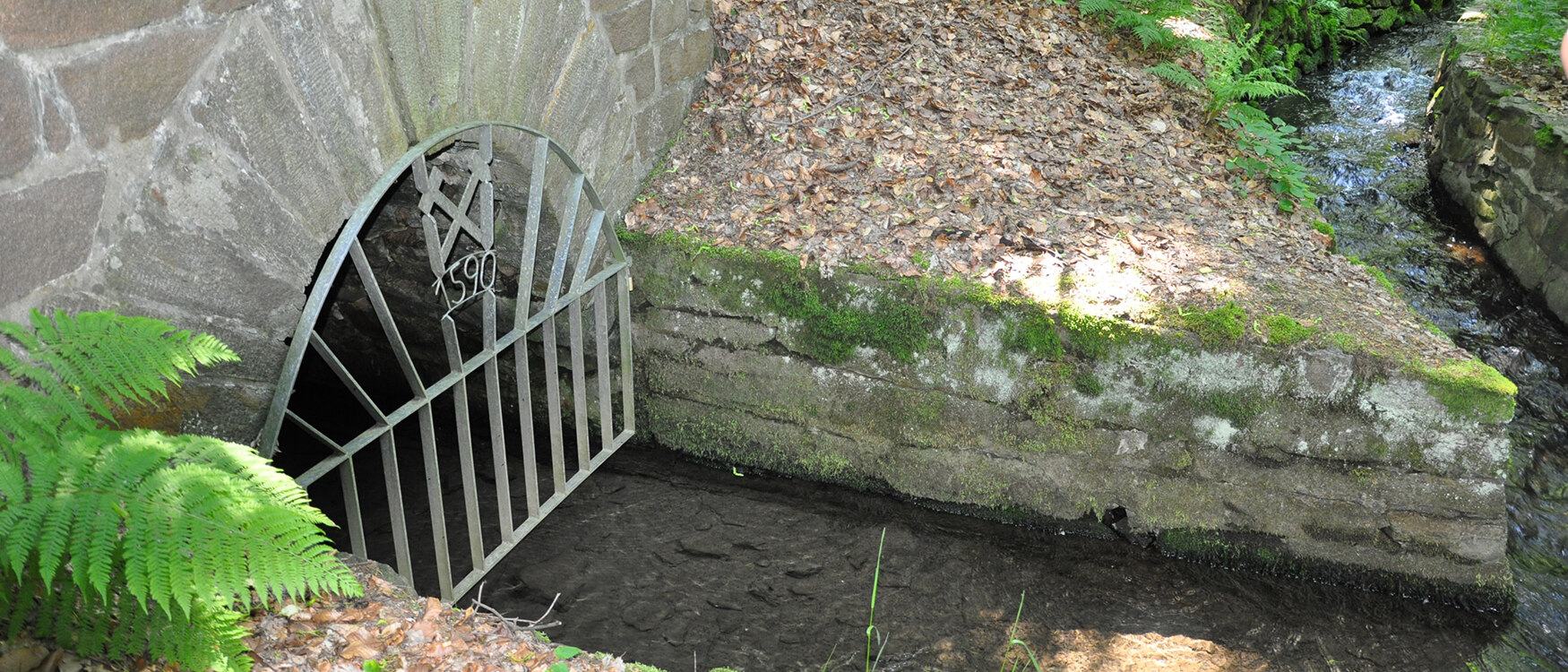

The Freiberg Mines Water Management System is a water supply system that has evolved over several centuries. It consists of a widely ramified network of gullets (water-bearing galleries) and water channels, which are altogether about 70 kilometers long and connect ten lakes.
The system has its origins in Freiberg silver mining. In 1158, silver was discovered in the Freiberg area. Immediately, a silver rush began, bringing many miners to the previously almost unsettled Ore Mountains. Initially, the silver ore near the surface could be recovered without much effort. From the 15th century, however, the miners had to dig deeper and deeper to find mineral resources. In the process, they encountered groundwater. The pits were drained with the help of watermen. Later, pumps driven by water power were used for this purpose.
Due to a lack of water, Freiberg's mining industry was threatened with extinction in the 16th century. By order of the Elector, the planned development of a water storage and supply system for Freiberg's mining and metallurgy began in 1558. After the Thirty Years' War (1618-1648), the Elector's Gallery and Gullet Administration was founded in 1684.As a central authority it was to harmonize the water needs of the mining industry and the city population.
Around 1900, however, Freiberg’ silver mining became unprofitable due to the introduction of the gold mark as the official currency and imports from overseas. It was completely shut down by 1914. The Freiberg Mines Water Management System was given new tasks: from then on, it was operated for drinking and process water supply, fish farming and energy production. Today, the Mines Water Management System supplies the regions of Freiberg, Chemnitz and Dresden with drinking and process water. It is part of the dam system "Middle and Eastern Ore Mountains”.
- Faltblatt: Revierwasserlaufanstalt Freiberg
- Faltblatt: Trinkwasser aus Sachsen
- Revierwasserlaufanstalt Freiberg: zwischen Vergangenheit und Zukunft Film über die Revierwasserlaufanstalt Freiberg
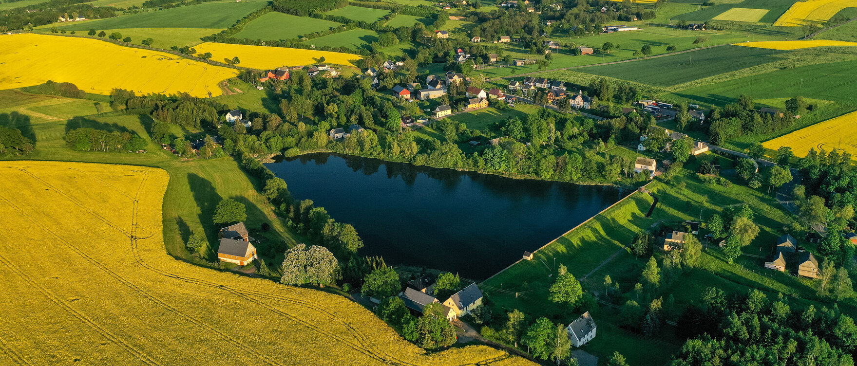

Four artificial lakes belong to the Upper Mines Water Management System: Upper Großhartmannsdorf Lake, Obersaida Lake, Dittmannsdorf Lake and Dörnthal Lake. They are all drinking water dams. Construction of Rauschenbach Dam in 1968 resulted in damming the Flöha water divider – the original starting point of the Freiberg Mines Water Management System. Since then, the drinking water dam has been the main reservoir of the system. From there, the water for the Chemnitz water supply is piped via Dörnthal Lake to Saidenbach Dam.
In addition, water can be piped from Upper Großhartmannsdorf Lake to Lichtenberg Dam via a pressure pipeline built in 2001. From there, the regions of Freiberg and the greater Dresden area can be supplied with drinking water.
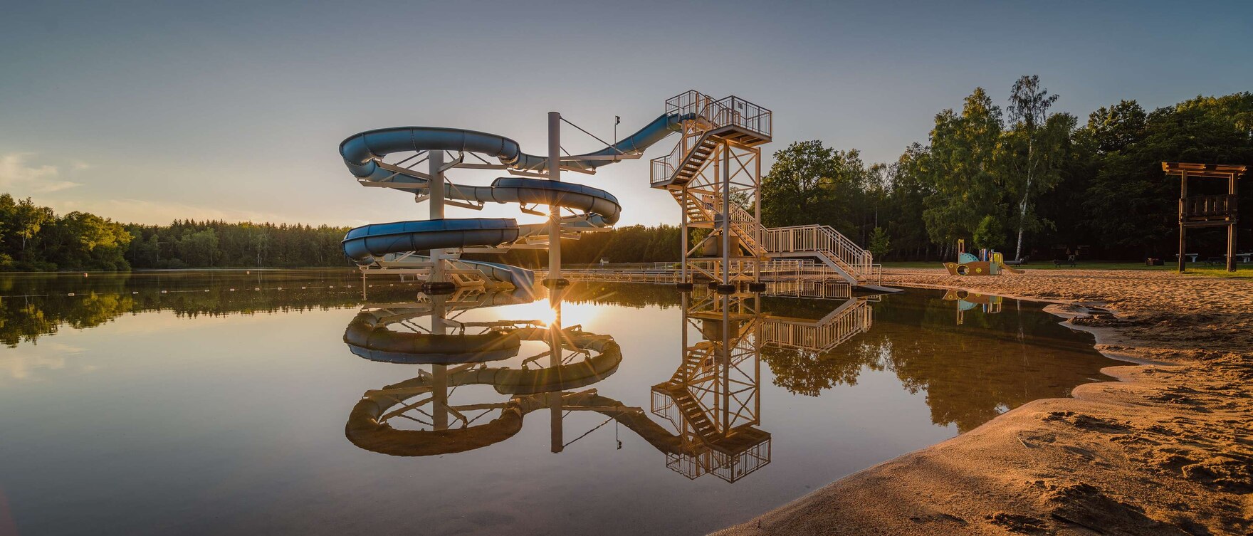

Six artificial lakes – Berthelsdorf Mining Lake, Konstantin Lake, Rothbächer Lake, Erzengler Lake and Middle and Lower Großhartmannsdorf Lake – belong to the Lower Mines Water Management System. They supply Freiberg‘s industry with process water and serve as flood protection. Some of the lakes are also used for fish farming or as fishing waters, others are developed for tourism. The Erzengler and Middle Großhartmannsdorf Lakes, for example, are for swimming. Other lakes, however, are located in nature reserves and are habitats for rare animal and plant species.
The Mines Water Management System has been a listed site since 1980, and since 2019 it has been a UNESCO World Heritage Site as part of the Ore Mountains/Krušnohori Mining Region.
Mining brought about a unique cultural landscape in Saxony and Bohemia, which is still visible everywhere in the Ore Mountains. Many historic buildings are still in use today. The cross-border character of the World Heritage sites is also unique: 17 of them are located in Saxony, Germany, five in Bohemia in the Czech Republic.
Since 1975, UNESCO has protected and preserved unique cultural and natural assets of outstanding universal value as the heritage of all mankind. This goes back to the Hague Convention of 1954, which for the first time laid down standards for the preservation of cultural heritage.
Seit 1980 steht die gesamte Revierwasserlaufanstalt unter Denkmalschutz. Vier der zehn Teiche dienen der Trinkwasserversorgung und können daher touristisch nicht genutzt werden. Zudem liegen die meisten Teiche in Naturschutzgebieten. Der Erzengler Teich ist allerdings ein europäisches Badegewässer. Auch am Mittleren Großhartmannsdorfer Teich gibt es ein Naturbad.